
Boston Neighbors: Block Sources
Public records can describe a Boston block in layers. The Boston parcel map identifies the lots at an address and the lots that share an edge. Boston Property Lookup adds the current owner display, Boston parcel identifier, tax data, and a tax mailing address. Suffolk recorded deeds add a dated Boston ownership trail. Those are useful, but none is a roll of every person present. A mailing address can belong to an owner, trustee, or tax correspondent outside Boston, and an owner entry does not establish that a person lives at the situs address.
| Block source | Boston detail it can provide | Access route |
|---|---|---|
| Boston Tax Parcel Viewer | Bordering Boston parcel shapes, MAP_PAR_ID, LOC_ID, rights-of-way, and map context | Public Boston parcel map |
| Boston Property Lookup | Boston owner display, situs, mailing address, parcel ID, value, tax, and exemption context | Boston address or parcel-ID search |
| Suffolk deed records | Boston grantor, grantee, recording date, legal description, book/page, and plans | Massachusetts Land Records |
| Boston permit files | Building work, applicant, builder, architect, and Boston alteration date | Online Boston address search; plans at the document room |
| Boston historic directories | Former Boston address-section entries and household clues for a particular year | BPL, digitized collections, or microfilm |
For Boston neighbors, begin with the smallest defensible claim. A Boston parcel connection can show an ownership relationship. A dated Boston directory can show that a named person appeared at an address in that edition. Neither result identifies children, guests, or every unit occupant. The distinction prevents a Boston block search from turning a narrow public record into a guess about private lives.
Boston Parcel Edges First
The Boston assessing FeatureServer connects Boston parcel geometry with tables for owners, taxes, sales, value history, residential attributes, condominium information, and other assessment data. It is especially useful when the Boston map and a tax display need to be compared. The parcel service can include water and rights-of-way, and a Boston tax polygon can lack a matching assessing record. Record that gap instead of assigning a nearby owner to it.
The FeatureServer image below shows the related assessing layers available for a Boston neighbors search.
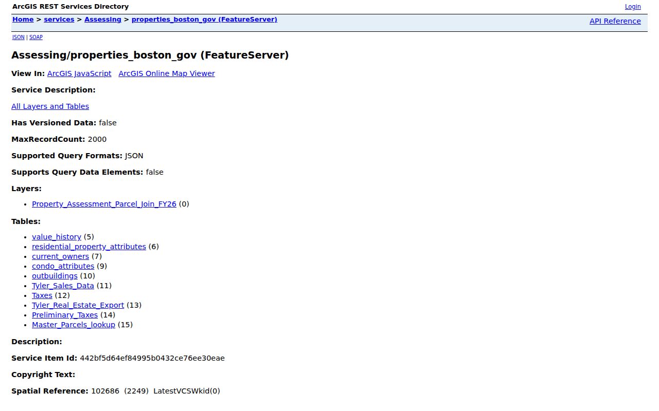
Use the display to keep the Boston map feature and its data table separate. A parcel boundary is a geographic fact; an owner field is an assessment record that may change after a transfer.
A parcel is a defined piece of land. MAP_PAR_ID and LOC_ID are map and location identifiers used in Boston’s parcel data. Keeping those identifiers with the street address makes it easier to revisit the same lot when a street is divided by an alley, a condominium, or a right-of-way.
Note: A tax parcel may connect to several assessing records, so compare the parcel shape and linked record before treating a displayed name as the full block picture.
Boston Neighbors: Owner Context
Boston Property Lookup accepts a situs address or a ten-digit parcel ID. It does not offer an owner-name search. Its Overview can show current owner names, owner mailing address, assessed value, property type, parcel ID, tax, exemptions, and a map link. Search the actual street address first, then retain the identifier before moving to the adjoining polygons. This order is more reliable than starting with a surname and hoping a block appears.
Situs means the place where the Boston parcel is located. A mailing address is where tax correspondence goes. The difference matters on a Boston block: a trust, a relative, a management address, or an owner who lives elsewhere can receive mail for the same parcel. A granted residential exemption can support a Boston owner’s tax claim of principal-residence use, but it is not a census of everyone there.
| Official record path | Strength | Limit |
|---|---|---|
| Boston parcel and assessment records | Trace a Boston lot to its current tax record | Does not list every occupant |
| Recorded deed chain | Dates transfers and identifies the parties to an instrument | Older deeds may use legal descriptions instead of a street address |
| Boston historic directory entry | Places a named person or business at a Boston address in one edition | Coverage and household representation vary |
| Commercial neighbor data category | May combine many data sources into a quick lead | Can be stale or merge different households; verify with the custodian |
This comparison keeps Boston neighbors research tied to the record’s real scope. For the full present-day street and deed sequence, use the separate Boston street directory route after the immediate bordering lots are clear.
Boston Voter Privacy Boundary
Massachusetts offers an individual voter-status form, not a public block directory. The form requires first and last name, birth month, day and year, the registered residential ZIP code, and an agreement statement. Its result can confirm an individual’s status and voting location information. It cannot be used as a bulk list of Boston neighbors, and it should not be treated as proof that a named person is at a given address.
Under M.G.L. c. 51 §47C, names and addresses in the central registry are not general public records. A lawful historical or election-related need may call for a specific Boston local-list request to the Boston Election Department, with the requested date, ward, and precinct stated clearly. The Department also administers the annual resident listing. Protected addresses, full birth dates, identification numbers, and ballot choices are not public results.
Boston Neighbors: Civic Contacts
A Boston civic group can help someone learn where a public meeting, abutters discussion, or neighborhood archive is located. It is not evidence that a person belongs to the group. Boston’s Neighborhood Services liaisons, newsletters, and community-meeting contacts are the citywide starting point. In Boston District 4, the City’s civic-association guide identifies several local groups, while warning by example that a meeting contact is not a public membership roster.
The Boston Neighborhood Services page is pictured here because it is the practical route to a liaison or public meeting for Boston neighbors.
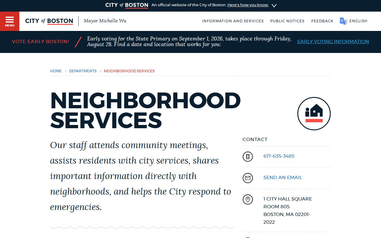
Contacting a liaison can point a researcher toward open civic information without asking an association to disclose private participant details.
Neighborhood Services
Citywide liaison, newsletter, meeting, and abutters connection. Use the City contact route for the relevant neighborhood.
Dorchester and Mattapan
Ashmont Hill, Fields Corner, Greater Mattapan, River Street, and other named civic associations appear in the District 4 guide.
Charlestown
The Charlestown Neighborhood Council is a public-meeting contact layer, not a directory of individual neighbors.
Map a Boston Block
The adjacent-parcel method starts with one known Boston address and follows lot boundaries outward. It works best for a small Boston shared-edge area, not for an arbitrary radius. Alleys, water, rights-of-way, and condominium parcels can make distance alone misleading. Each step should keep the map record, assessment detail, and deed trail in their proper roles.
- Find the target address in the Boston Tax Parcel Viewer and note its MAP_PAR_ID, LOC_ID, and parcel shape.
- Click each bordering polygon and record its identifier before opening the matching Property Lookup result.
- Compare the situs, owner display, mailing address, and any linked sales or tax context without calling a mailing address an occupancy record.
- When ownership timing matters, search the parcel’s legal description, plan, grantor, or grantee in Suffolk records and follow the dated instrument.
That flow is address to parcel, parcel to assessment record, assessment record to deed, then deed to a dated ownership trail. It is narrower than a named-street review and helps keep Boston neighbors work focused on the immediate block.
Boston Neighbors Through Time
Historic Boston blocks can change names, numbers, and jurisdictions. South Boston, East Boston, Roxbury, Dorchester, Brighton, West Roxbury-area communities, and Hyde Park joined Boston at different times. A former town name may be the key to an older directory or deed entry. The 1872 Great Fire also reshaped downtown streets and businesses, so an abrupt change in a property description may reflect rebuilding rather than a household move.
For an older block, pair a city-directory address section with a Sanborn or real-estate atlas, tax material, and the deed record. The Boston Public Library’s directory collections, Boston Streets mapped data, and the Massachusetts Archives’ historic Suffolk deeds provide different pieces of that trail. A 1890 census gap should be filled with adjacent directory editions and other dated records rather than guessed at.
Note: Older Boston entries may appear under an annexed town or neighborhood label, so search both the modern address and the historic place name.
Boston Neighbor Lookup Limits
Some information about Boston neighbors is deliberately private. Public parcel fields do not identify every renter, child, guest, utility customer, delivery recipient, or person at a protected address. RMV information is restricted by the federal Driver’s Privacy Protection Act. Court records can be sealed or impounded, and recent vital records have separate access rules. A missing name can be a privacy safeguard, not a reason to search more aggressively.
Massachusetts Address Confidentiality Program participants can use a substitute address and mail forwarding. The program serves qualifying survivors of domestic violence, sexual assault, or stalking, along with certain legally protected health-care providers. The Public Records Law also has exemptions, while M.G.L. c. 66 §10 sets the general request process. Ask the custodian for a defined, non-exempt record rather than trying to reconstruct private details from unrelated sources.
Lawful use. Boston neighbor records can support civic curiosity, family history, and property research. M.G.L. c. 265 §§43 and 43A address stalking and criminal harassment, so never use an address trail to watch, intimidate, or harm anyone.